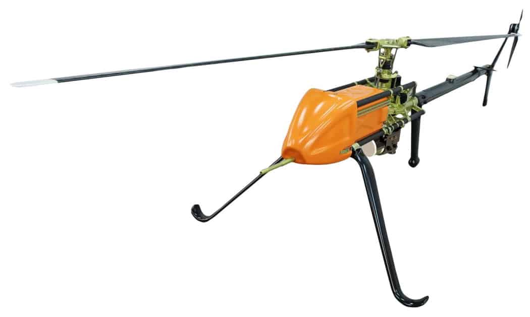


UAVOS has confirmed that it has undertaken a railway utility inspection project using the company’s UAVs (unmanned aerial vehicles) and photogrammetry/GIS software. The project involved inspection of over 3000 km of railway infrastructure including rails, power lines, and other utilities.
The goal of the project was to apply unmanned inspection techniques to the mapping of railway infrastructure for accurate visualization, providing fast and precise potential damage identification and thus increasing workplace safety for railway employees.
The data collection was performed with UAVOS’ UVH-25EL electric unmanned helicopter and Borey fixed-wing drone, equipped with two different types of sensors – LiDAR for a georeferenced 3D point cloud, and a Sony digital camera for 3D spatial data. Additionally, UAVOS conducted high-volume data measurement management, and combining of tachymetric surveying with aerial photographs and LiDAR data to help include it in the GIS base.
Terrestrial control measurements were performed to determine the measurement accuracy of the coordinates and heights of the reference geodetic networks. The accuracy of determining the coordinates and heights of the reference geodetic networks then allowed the creation of a precision 3D point cloud. Aerial surveys were then carried out and data processing was performed. The goal of the project was to analyze high-accuracy spatial data and create a 3D line map from airborne digital photogrammetry. The high-precision aerial images allowed the UAVOS team to identify structural integrity, potential defects such as broken insulators, and the condition of the pylons.
Results and benefits for the railway company included:
- 500,000 RGB images have been taken and huge amounts of defects were found
- Highly-accurate 3D spatial data was created during post-processing for GIS
- Infrastructure data inspection collection has led to dramatic cost reduction in the railway company’s land lease, due to the boundary specification of the land allotment
More precise railway utilities data was collected compared to traditional inspection methods, and the generated reports were easy to use by maintenance teams who conduct repair work, speeding up the inspection process and ensuring overall safety.
UAVOS’ electric UVH-EL25 unmanned helicopter and Borey fixed-wing UAV are ideal for railway infrastructure survey, offering easy and safe aerial access to challenging areas, a larger surface coverage in a single flight, higher resolution images, and efficient and cost-effective aerial data acquisition.
The Borey fixed-wing UAV, with MTOW of 15 kg, is capable of carrying up to 4 kg of payload for up to 1 hour with a range of up to 220 km. The UVH-25EL unmanned helicopter has been specially designed for commercial use and data capturing applications using a LiDAR system as an all-in-one 3D mapping device. The fully autonomous UVH-25EL is equipped with an electric engine unit and features a flight endurance of up to 1.5 hours when carrying a payload of 5 kg.
Aliaksei Stratsilatau, CEO of UAVOS, commented: “Railway companies have a strong interest in developing data systems to gain a better overview of the infrastructure. Therefore, we were glad to complete a project with our client to digitize the railway grid, thus improving inspection and maintenance.”


Related Posts
New Drone Fires Thales Missile in Unmanned Air Combat Milestone
UAS Startup Accelerator Awards 3M in Funding
US Navy Orders Unmanned Tactical Resupply Aircraft