


Sunhillo has updated its Surveillance Monitoring System (SMS), building upon a system that was recently deployed to the US Army Alaska (USARAK) Ranges to provide enhanced situational awareness and support for training exercises. New upgrades include a moving map that tracks a designated UAV (unmanned aerial vehicle) and keeps the view centered as the aircraft traverses, providing configurable, concentric geofence filters to facilitate visual and audible alerts from approaching aircraft for safety and situational awareness.
The SMS receives multiple disparate surveillance feeds, such as traditional radar or ADS-B, and displays them on a customizable map. A major discriminator of the SMS is that no internet connection is required, as the maps are available for offline use which is critical for remote UAS operations. Custom overlays such as aeronautical charts, ArcGIS images and other georeferenced imagery can be used to enrich the detail of the map.
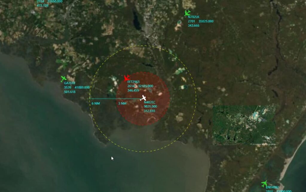
With a fully customizable display and Geofencing, the SMS provides the situational awareness necessary for Beyond Visual Line of Sight (BVLOS) and controlled airspace UAS operations. Selecting any target on the SMS provides details such as target ID, aircraft identification information and latitude/longitude coordinates.
The SMS’ geofencing is configured by creating a polygon fence based on latitude/longitude coordinates, drawing on the map or Shape file import. Targets approaching or entering the geofenced area can be configured to trigger an alert. This update improves on geofencing by shadowing the targeted UAV as it progresses across the map. This gives UAS pilots and operation centers a focused area for situational awareness and is ideally suited for BVLOS operations.
Dave Whitman, CEO and President of Sunhillo Corporation, commented: “The latest version of SMS builds upon our successfully deployed surveillance systems with new enhancements for UAS operations and geofencing that will provide the situational awareness required for safe operations.”


Related Posts
New Drone Fires Thales Missile in Unmanned Air Combat Milestone
UAS Startup Accelerator Awards 3M in Funding
US Navy Orders Unmanned Tactical Resupply Aircraft